
Page 12 - North American Clean Energy March/April 2019 Issue
P. 12
solar energy
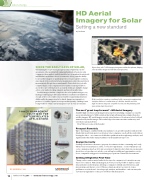
HD Aerial Imagery for Solar
Setting a new standard
by Tim Frank
SINCE THE EARLY DAYS OF SOLAR,
determining the scope of any given project has required an on-site assessment of the potential job, eating up hundreds of hours for solar companies, their analysts, and the installer (not to mention the safety risk and liabilities attendant to these assessments). Along came the ability
to use satellite imagery to qualify properties; it wasn’t a perfect solution, since much of the roof detail is lost at maximum zoom levels, and critical measurements like pitch were unattainable. Particularly for roofs with complex shapes, solar companies have found it nearly impossible to assess the scope of their projects accurately, leading to multiple change orders, over/under stocking of panels, and wasted installer time.
Satellite imagery further complicates the solar quali cation process, making it challenging to determine whether nearby trees would block enough of the roof to render solar not viable for a particular structure. Additionally, the images tend to be dated. Images are expensive to produce, so satellite capture is not repeated frequently – making it next to impossible to obtain current imagery for use in solar assessments.
Up-to-date, sub 3" GSD imagery integrates within the software, helping solar installers design and sell with exact precision.
High-resolution captures combined with a responsive engineering interface deliver a combination of 3-D lidar models and 2-D high-resolution maps for complete accuracy in the planning and measuring stage of a project.
POWER MANAGEMENT SOLUTIONS FOR BATTERY-RELATED APPLICATIONS
HYBRID OVERCURRENT PROTECTIVE DEVICES
BUS BAR
HEAT SINKS
DC FUSES
FLEXIBLE MONITORING
LIQUID COLD PLATE
EP.MERSEN.COM
12
MARCH•APRIL2019 /// www.nacleanenergy.com
The next ‘great leap forward’ - HD Aerial Imagery
Available high-resolution aerial imagery is far superior in helping companies accurately assess potential projects. With resolution that is typically many times sharper than free satellite imagery, HD aerial imagery reveals critical features of locations at a level of detail unmatched by satellite images. e results help solar teams save time and money, and serve their customers better.
How? Here are some of the bene ts:
Prospect Remotely
Up-to-date images, combined with solar industry tools, provide installers with all of the details they need, from quote to activation. Solar companies can do all the work without leaving the o ce. One contractor doubled its quali cations through image analysis, and signi cantly reduced the turnaround time on the quali cation process.
Design Correctly
Sending technicians to measure a property for estimates is time-consuming and costly, when you factor in insurance, safety, or even lost opportunity. On-site evaluations can cost a company as much as $300 per assessment. A typical solar technician can measure about ve roofs per day; not only do costs add up, but additional opportunities can be lost to companies using precise aerial imagery to perform ‘Virtual Site Assessments.’
Getting it Right the First Time
Change orders can be a major headache for any solar company, not to mention an easy way to lose contracts. With aerial imagery, however, it’s now possible to make accurate measurements on the rst pass, allowing a company to identify any obstructions, and present proposals that are correct. When a solar proposal isn’t accurate, it creates problems across the board – for salespeople, analysts, and installers – and can annoy the customer enough that he or she goes elsewhere with their project.
