

GIS Can Aid in the Fight Against Climate Change


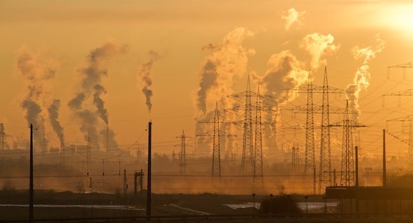
The World Economic Forum met earlier this year to discuss climate change, noting that recent annual average temperatures are sitting at 1.2 degrees Celsius above pre-industrial levels. This, according to the findings revealed at the Forum, is a key indicator that the situation is worsening. With temperatures rising across the globe, extreme weather events have become more frequent and costly.
To curtail the impacts of rising temperatures, leaders are working to reduce the world’s reliance on fossil fuels, and transition to eco-friendly, clean, renewable energy sources, such as solar power or wind farms.
Renewable Energy Can Mitigate Climate Change
In 2021 President Biden announced his goal to reduce greenhouse gas emissions to 50-52 percent below 2005 levels nationally by 2030. This deadline looms with less than seven years left to go. Thankfully, with the passage of the Inflation Reduction Act, the clean energy sector received an investment of $369 billion to help push efforts forward. With it, some states are already relying more heavily on alternatives like solar or wind farms. In fact, 24 percent of U.S. electricity generated in the first half of 2022 came from renewable sources.
Emissions are currently set to decrease by 0.3 percent, but this pace will need to quicken to meet the nation’s climate goals and outpace existing effects. Climate change has brought about severe weather conditions that can impact the efficiency of solar farms. For instance, the frequency of warm weather and cloud coverage can limit the output of solar panels. What’s more, heat waves can reduce the output of solar panels by 10 to 25 percent. So, it’s critical to the success of renewable energy projects for developers to select the right parcel of land in the right areas.
As the need for renewable energy increases, developers must scale their teams to keep up with demands and complete projects accurately and on time. But development teams don’t have to do it alone. Tools like geographic information systems (GIS) can simplify projects.
 Clean Energy Teams Need GIS to Meet Climate Change Goals
Climate scientists and researchers have used geographic information to create comprehensive pictures of how our planet has changed over time. Researchers have also used GIS technology in their study of climate change's impact on our world, such as changes in air quality, risks to city infrastructure, and more. But GIS applications can go beyond scientific research, to business use.
Renewable energy developers can use GIS to:
- Find suitable land for projects such as wind or solar farms.
- Manage risks associated with land development.
- Support team collaboration to execute on a clear vision.
- Increase efficiency in today’s competitive market through effective, data-rich mapping capabilities.
Imagine a scenario where a solar developer is tasked with finding a 400-acre property suitable for solar farm development. That means the property should be outside flood zones, relatively flat, and near the proper electric infrastructure. The developer also needs information on elevation, slope, soils, and more to determine the buildability of the site to help reduce risks like flooding or receding land areas.
To find the necessary information, developers have two options. First, they can cycle through various sources of land information from disparate county, state, or federal resources. This option can take days, or even weeks, to collect and analyze the data, since it can be difficult to combine these datasets for effective comparison when they often use different record systems. The second, and more straightforward, option is to use GIS to compile all the necessary information in one centralized platform -- simplifying the lengthy search and comparison processes. The effective choice is obvious.
With GIS at their fingertips, solar development teams can also improve the client and investor management process. A comprehensive GIS platform, featuring strong data presentations, allows developers to walk clients through site options while explaining project design plans remotely, without needing to travel to the location. Developers can also create reports on power usage across areas of interest to understand natural resource needs and determine the projects that will best address them.
Widespread use of GIS will help developers make these decisions quickly, both increasing project impact and shortening the time to completion. More solar and wind farms will allow our country to utilize more renewable energy sources to meet its power needs, reducing the need for fossil fuels, and ultimately helping our nation reach its master clean energy goal by the 2030 deadline.
Christopher Nichols serves as the leader of geothinQ, a geographic land mapping and data visualization software. He has over 25 years of experience working with GIS and remote sensing technology.
geothinQ | geothinq.com
Author: Christopher Nichols
Volume: 2023 March/April